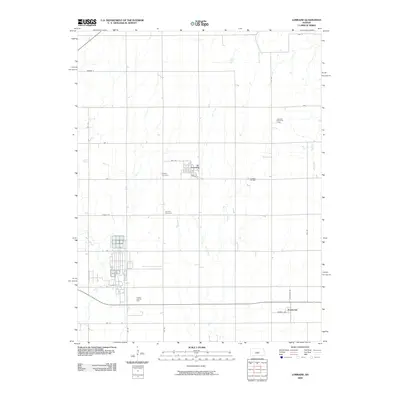
2009 Map of Lorraine
USGS Topo · Published 2009About this map
The town of Lorraine sits at the heart of this Ellsworth County landscape, serving as a central point for the surrounding agricultural and industrial activity. The area's economic history is clearly defined by the presence of energy resources, including the Lorraine Oil Field, the Lorraine North Oil Field, and the Prosper East Oil Field. These sites illustrate the region's long-standing reliance on sub-surface minerals alongside its surface farming.
Find a feature on this map
28 named features on this map. Tap any name to fly to it.
Don’t see what you’re looking for? This feature index may not catch every label — zoom into the map to look around manually.
Map Details
Editions of this 2009 Lorraine Map
This is the sole edition of this map. No revisions or reprints were ever made.
Other maps of this area

1894 · Ellsworth
USGS Topo · 1:125,000

1894 · Lyons
USGS Topo · 1:125,000

1955 · Great Bend
USGS Topo · 1:250,000

1957 · Great Bend
USGS Topo · 1:250,000

1957 · Ellsworth
USGS Topo · 1:24,000

1957 · Holyrood NE
USGS Topo · 1:24,000

1958 · Great Bend
USGS Topo · 1:250,000
1964 · Holyrood NW
USGS Topo · 1:24,000
1964 · Holyrood
USGS Topo · 1:24,000
1964 · Geneseo
USGS Topo · 1:24,000