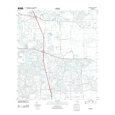
2012 Map of Lorraine
USGS Topo · Published 2012About this map
The Braden River winds through a landscape increasingly defined by expanding residential street networks and managed water bodies in this 2012 study of the area east of Bradenton. The small settlement of Lorraine sits at a junction near Wolf Slough, surrounded by a grid of numbered roads like 59th Ave E and 44th Ave E. This era shows the transition of traditional agricultural land into suburban developments, though older landmarks remain, such as the Braden River Cem and the Bradenton Fire Tower.
Find a feature on this map
175 named features on this map. Tap any name to fly to it.
Don’t see what you’re looking for? This feature index may not catch every label — zoom into the map to look around manually.
Map Details
Editions of this 2012 Lorraine Map
This is the sole edition of this map. No revisions or reprints were ever made.
Other maps of this area

1921 · Fort De Soto
USGS Topo · 1:62,500

1944 · Sarasota
USGS Topo · 1:31,680

1944 · Rye
USGS Topo · 1:31,680

1944 · Verna
USGS Topo · 1:31,680

1944 · Lorraine
USGS Topo · 1:31,680

1944 · Ellenton
USGS Topo · 1:31,680

1944 · Parish
USGS Topo · 1:31,680

1944 · Miakka
USGS Topo · 1:31,680

1947 · Bradenton
USGS Topo · 1:24,000

1947 · Bee Ridge
USGS Topo · 1:24,000