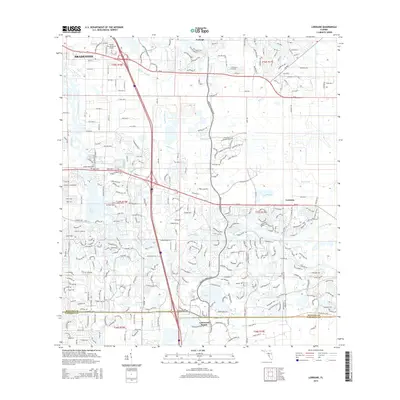
2015 Map of Lorraine
USGS Topo · Published 2015About this map
Braden River meanders through the heart of this coastal Florida landscape, defining a region where modern planned development meets traditional Gulf Coast wetlands. The expansion of Lakewood Ranch and the eastern reaches of Bradenton are evident, with residential corridors like Lakewood Ranch Blvd and University Pky carving through former agricultural and pasture lands. The landscape remains heavily influenced by its drainage patterns, from the wide Cypress Strand to the winding Wolf Slough and Rattlesnake Slough.
Find a feature on this map
31 named features on this map. Tap any name to fly to it.
Don’t see what you’re looking for? This feature index may not catch every label — zoom into the map to look around manually.
Map Details
Editions of this 2015 Lorraine Map
This is the sole edition of this map. No revisions or reprints were ever made.
Other maps of this area

1921 · Fort De Soto
USGS Topo · 1:62,500

1944 · Sarasota
USGS Topo · 1:31,680

1944 · Rye
USGS Topo · 1:31,680

1944 · Verna
USGS Topo · 1:31,680

1944 · Lorraine
USGS Topo · 1:31,680

1944 · Ellenton
USGS Topo · 1:31,680

1944 · Parish
USGS Topo · 1:31,680

1944 · Miakka
USGS Topo · 1:31,680

1947 · Bradenton
USGS Topo · 1:24,000

1947 · Bee Ridge
USGS Topo · 1:24,000