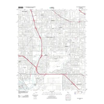
2012 Map of Los Alamitos
USGS Topo · Published 2012About this map
Los Alamitos Army Airfield and the adjacent Los Alamitos Racetrack anchor this densely developed portion of southern Los Angeles and northern Orange Counties. The landscape is defined by its complex water management systems, including the San Gabriel River, Coyote Cr, and a network of engineered paths like the Rossmoor Storm Channel and Stanton Storm Channel. These channels weave through a grid of residential and commercial expansion, connecting established communities such as Cerritos, Cypress, and Hawaiian Gardens.
Find a feature on this map
84 named features on this map. Tap any name to fly to it.
Don’t see what you’re looking for? This feature index may not catch every label — zoom into the map to look around manually.
Map Details
Editions of this 2012 Los Alamitos Map
This is the sole edition of this map. No revisions or reprints were ever made.
Other maps of this area

1896 · Santa Ana
USGS Topo · 1:62,500

1896 · Anaheim
USGS Topo · 1:62,500

1896 · Las Bolsas
USGS Topo · 1:62,500

1896 · Downey
USGS Topo · 1:62,500

1898 · Anaheim
USGS Topo · 1:62,500

1899 · Downey
USGS Topo · 1:62,500

1901 · Southern California Sheet No. 1
USGS Topo · 1:250,000

1901 · Santa Ana
USGS Topo · 1:62,500

1901 · Anaheim
USGS Topo · 1:62,500

1902 · Downey
USGS Topo · 1:62,500