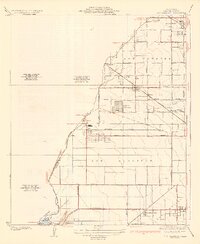
1935 Map of Los Alamitos
USGS Topo · Published 1935About this map
Industrial and agricultural land uses intersect along the coastal plain of Orange County in the mid-1930s. The Texas Oil Tank Farm stands as a prominent landmark near Cypress, reflecting the region's developing energy sector. Transportation is defined by a dense grid of rural boulevards like Katella Avenue and Ocean Avenue, alongside the tracks of the Southern Pacific and Pacific Electric railroads. These lines connect small track-side settlements including Moody and Halcon with larger hubs like Los Alamitos.
Find a feature on this map
43 named features on this map. Tap any name to fly to it.
Don’t see what you’re looking for? This feature index may not catch every label — zoom into the map to look around manually.
Map Details
Editions of this 1935 Los Alamitos Map
2 editions found
Other maps of this area

1896 · Santa Ana
USGS Topo · 1:62,500

1896 · Anaheim
USGS Topo · 1:62,500

1896 · Las Bolsas
USGS Topo · 1:62,500

1896 · Downey
USGS Topo · 1:62,500

1898 · Anaheim
USGS Topo · 1:62,500

1899 · Downey
USGS Topo · 1:62,500

1901 · Southern California Sheet No. 1
USGS Topo · 1:250,000

1901 · Santa Ana
USGS Topo · 1:62,500

1901 · Anaheim
USGS Topo · 1:62,500

1902 · Downey
USGS Topo · 1:62,500