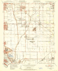
1950 Map of Los Alamitos
USGS Topo · Published 1950About this map
The San Gabriel River and Coyote Creek define a landscape on the border of Los Angeles and Orange Counties during a period of rapid suburban and industrial expansion. The presence of the Naval Reservation and Naval Hospital highlights the area's strategic importance following the war, while aviation hubs like Cranford Airport and the Cypress School of Aeronautics reflect the era's burgeoning aerospace culture.
Find a feature on this map
62 named features on this map. Tap any name to fly to it.
Don’t see what you’re looking for? This feature index may not catch every label — zoom into the map to look around manually.
Map Details
Editions of this 1950 Los Alamitos Map
This is the sole edition of this map. No revisions or reprints were ever made.
Other maps of this area

1896 · Santa Ana
USGS Topo · 1:62,500

1896 · Anaheim
USGS Topo · 1:62,500

1896 · Las Bolsas
USGS Topo · 1:62,500

1896 · Downey
USGS Topo · 1:62,500

1898 · Anaheim
USGS Topo · 1:62,500

1899 · Downey
USGS Topo · 1:62,500

1901 · Southern California Sheet No. 1
USGS Topo · 1:250,000
1901 · Santa Ana
USGS Topo · 1:62,500
1901 · Anaheim
USGS Topo · 1:62,500
1902 · Downey
USGS Topo · 1:62,500