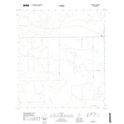
2019 Map of Los Angeles
USGS Topo · Published 2019About this map
Los Angeles stands as a primary point of interest in this section of La Salle County, situated along the corridor of State Highway 97. The landscape is defined by the ephemeral drainage of the Brush Country, with Nogate Cr cutting across the northern reaches and Charco Marrano Cr appearing to the south. This 2019 survey by the U.S. Geological Survey illustrates the intersection of modern ranching infrastructure and natural waterways. Local transport is marked by numerous rural tracks and roads with distinctive names such as Dirty Shame Rd, Mummies Rd, and Jim O Field Rd, reflecting the local heritage and naming conventions of this South Texas region. The map provides a clear view of the sparse settlement patterns and the network of ranch roads, including Ranch Rd 469, that connect these isolated homesteads and pastures.
Find a feature on this map
10 named features on this map. Tap any name to fly to it.
Don’t see what you’re looking for? This feature index may not catch every label — zoom into the map to look around manually.
Map Details
Editions of this 2019 Los Angeles Map
This is the sole edition of this map. No revisions or reprints were ever made.
Other maps of this area

1929 · Cotulla
USGS Topo · 1:125,000

1940 · Cotulla
USGS Topo · 1:62,500

1942 · Fowlerton
USGS Topo · 1:62,500

1942 · Dilley
USGS Topo · 1:62,500

1953 · Crystal City
USGS Topo · 1:250,000

1955 · Crystal City
USGS Topo · 1:250,000

1956 · Hindes
USGS Topo · 1:62,500

1956 · Fowlerton
USGS Topo · 1:62,500

1961 · Crystal City
USGS Topo · 1:250,000

1968 · Crystal City
USGS Topo · 1:250,000