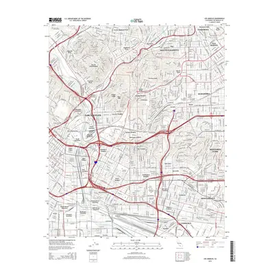
2015 Map of Los Angeles
USGS Topo · Published 2015About this map
The Los Angeles River and Arroyo Seco carve through a dense urban corridor, defining the industrial and residential evolution of East Los Angeles. This 2015 perspective highlights the massive concentration of final resting places in the Whittier Boulevard corridor, including Evergreen Cemetery, Calvary Cemetery, and the Mausoleum of the Golden West. These landmarks stand alongside educational centers like California State University-Los Angeles and East Los Angeles College. The map captures the intricate rail and road infrastructure that binds neighborhoods such as Boyle Heights, City Terrace, and Lincoln Heights to the commercial hubs of Commerce and Vernon. Transport junctions like Soto Street Junction and Redondo Junction illustrate the continuing importance of rail logistics to the region's economy.
Find a feature on this map
94 named features on this map. Tap any name to fly to it.
Don’t see what you’re looking for? This feature index may not catch every label — zoom into the map to look around manually.
Map Details
Editions of this 2015 Los Angeles Map
This is the sole edition of this map. No revisions or reprints were ever made.
Other maps of this area

1894 · Los Angeles
USGS Topo · 1:62,500

1896 · Pasadena
USGS Topo · 1:62,500

1896 · Redondo
USGS Topo · 1:62,500

1896 · Santa Monica
USGS Topo · 1:62,500

1896 · Downey
USGS Topo · 1:62,500

1898 · Santa Monica
USGS Topo · 1:62,500

1899 · Downey
USGS Topo · 1:62,500

1900 · Pasadena
USGS Topo · 1:62,500

1900 · Los Angeles
USGS Topo · 1:62,500

1901 · Southern California Sheet No. 1
USGS Topo · 1:250,000