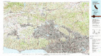
1979 Map of Los Angeles
USGS Topo · Published 1979About this map
The San Fernando Valley dominates this late-1970s landscape, illustrating the dense urban expansion of Los Angeles, Glendale, and Pasadena as they push against the steep slopes of the San Gabriel Mountains. The map provides a detailed view of the regional infrastructure that defined this era, including the Southern Pacific rail lines and the maturing freeway system, such as the Golden State Freeway and Santa Monica Freeway.
Find a feature on this map
111 named features on this map. Tap any name to fly to it.
Don’t see what you’re looking for? This feature index may not catch every label — zoom into the map to look around manually.
Map Details
Editions of this 1979 Los Angeles Map
This is the sole edition of this map. No revisions or reprints were ever made.
Other maps of this area

1894 · Los Angeles
USGS Topo · 1:62,500

1894 · Pomona
USGS Topo · 1:62,500

1896 · Pasadena
USGS Topo · 1:62,500

1896 · Anaheim
USGS Topo · 1:62,500

1896 · Redondo
USGS Topo · 1:62,500

1896 · Santa Monica
USGS Topo · 1:62,500

1896 · Downey
USGS Topo · 1:62,500

1897 · Pomona
USGS Topo · 1:62,500

1898 · Pomona
USGS Topo · 1:62,500

1898 · Santa Monica
USGS Topo · 1:62,500