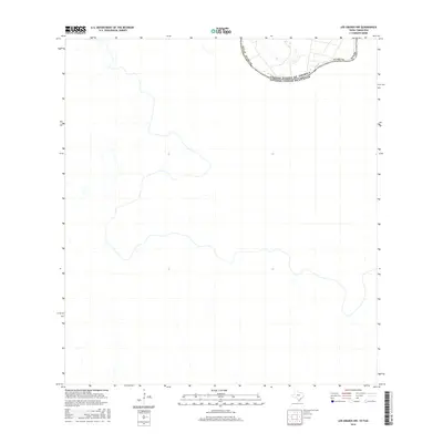
2016 Map of Los Ebanos NW
USGS Topo · Published 2016About this map
The Rio Grande serves as the defining geographic and political boundary on this map, marking the divide between United States of America and Estados Unidos Mexicanos. Located within the southern reaches of Texas Starr Co, the landscape is dominated by the winding path of the river, which dictates the layout of international borders and local property lines. The survey captures the arid terrain typical of the South Texas borderlands, where the water's course is the primary landmark for both navigation and administration. While the northern portion of the map identifies the jurisdiction of Starr Co Texas, much of the area reflects the sparsely populated but strategically significant riverfront at this point in the mid-2010s.
Find a feature on this map
4 named features on this map. Tap any name to fly to it.
Don’t see what you’re looking for? This feature index may not catch every label — zoom into the map to look around manually.
Map Details
Editions of this 2016 Los Ebanos NW Map
This is the sole edition of this map. No revisions or reprints were ever made.
Other maps of this area

1949 · Mc Allen
USGS Topo · 1:250,000

1954 · McAllen
USGS Topo · 1:250,000

1956 · Garcias
USGS Topo · 1:62,500

1956 · Los Ebanos
USGS Topo · 1:62,500

1956 · Escobares
USGS Topo · 1:62,500

1957 · Mc Allen
USGS Topo · 1:250,000

1962 · McAllen
USGS Topo · 1:250,000

1965 · Rio Grande City South
USGS Topo · 1:24,000

1965 · La Grulla
USGS Topo · 1:24,000
1965 · Sullivan City
USGS Topo · 1:24,000