
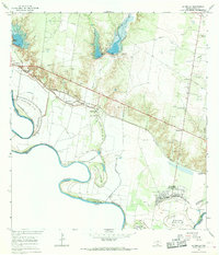
1965 Map of La Grulla
USGS Topo · Published 1968About this map
Rio Grande meanders along the international border in this mid-1960s study, defining a landscape marked by a complex system of bancos—land parcels separated from their parent nations by shifts in the river's course. Features like El Refugio Banco No 92, Santo Domingo Banco No 55, and Villarreales Banco No 136 illustrate the dynamic nature of the border between United States and Mexico. The agricultural and residential settlements of La Puerta, Garciasville, and La Grulla parallel the Missouri Pacific railroad, which served as a vital corridor for the region's economy.
Find a feature on this map
26 named features on this map. Tap any name to fly to it.
Don’t see what you’re looking for? This feature index may not catch every label — zoom into the map to look around manually.
Map Details
Editions of this 1965 La Grulla Map
2 editions found
Other maps of this area

1949 · Mc Allen
USGS Topo · 1:250,000

1954 · McAllen
USGS Topo · 1:250,000

1956 · Garcias
USGS Topo · 1:62,500

1956 · Los Ebanos
USGS Topo · 1:62,500

1956 · Escobares
USGS Topo · 1:62,500

1957 · Mc Allen
USGS Topo · 1:250,000

1962 · McAllen
USGS Topo · 1:250,000

1965 · Rio Grande City South
USGS Topo · 1:24,000
1965 · Sullivan City
USGS Topo · 1:24,000
1965 · Camp Garcia
USGS Topo · 1:24,000