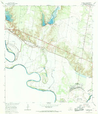
1965 Map of La Grulla
USGS Topo · Published 1968About this map
The Rio Grande defines the character of this Starr County borderland, where the international boundary shifts alongside dynamic river bends and numerous bancos. Along the northern bank, the Missouri Pacific railroad corridor serves as the spine for a string of Texas settlements including La Puerta, La Casita, and Garciasville. The map captures a landscape of transition, where agricultural pumping stations and gravel pits operate near established community landmarks like La Union Sch and the San Ignacio de Loyola church.
Find a feature on this map
31 named features on this map. Tap any name to fly to it.
Don’t see what you’re looking for? This feature index may not catch every label — zoom into the map to look around manually.
Map Details
Editions of this 1965 La Grulla Map
2 editions found
Other maps of this area

1949 · Mc Allen
USGS Topo · 1:250,000

1954 · McAllen
USGS Topo · 1:250,000

1956 · Garcias
USGS Topo · 1:62,500

1956 · Los Ebanos
USGS Topo · 1:62,500

1956 · Escobares
USGS Topo · 1:62,500

1957 · Mc Allen
USGS Topo · 1:250,000

1962 · McAllen
USGS Topo · 1:250,000

1965 · Rio Grande City South
USGS Topo · 1:24,000

1965 · La Grulla
USGS Topo · 1:24,000
1965 · Sullivan City
USGS Topo · 1:24,000