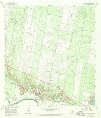
1965 Map of Sullivan City
USGS Topo · Published 1968About this map
The Rio Grande marks the international boundary between Texas and Mexico in this mid-1960s survey, a landscape defined by the shifting course of the river and the growth of the energy industry. Along the northern bank, the Missouri Pacific railroad corridor serves as the primary artery for Sullivan City and the neighboring settlement of Cuevitas. The presence of several river bends identified as bancos, including La Chicharra Banco No 94 and Santos Banco No 95, highlights the complex border geography where the river's movements necessitated formal land designations.
Find a feature on this map
27 named features on this map. Tap any name to fly to it.
Don’t see what you’re looking for? This feature index may not catch every label — zoom into the map to look around manually.
Map Details
Editions of this 1965 Sullivan City Map
2 editions found
Other maps of this area

1940 · Monte Christo
USGS Topo · 1:62,500

1949 · Mc Allen
USGS Topo · 1:250,000

1954 · McAllen
USGS Topo · 1:250,000

1956 · Garcias
USGS Topo · 1:62,500

1956 · Los Ebanos
USGS Topo · 1:62,500

1957 · Mc Allen
USGS Topo · 1:250,000

1962 · McAllen
USGS Topo · 1:250,000

1963 · La Joya
USGS Topo · 1:24,000

1963 · Citrus City
USGS Topo · 1:24,000
1963 · McCook
USGS Topo · 1:24,000
Featured Places
- Sullivan City, TX
- La Grulla, TX
- Buena Vista Colonia, TX
- Vales Colonia, Sullivan City
- Benevides Colonia, Sullivan City