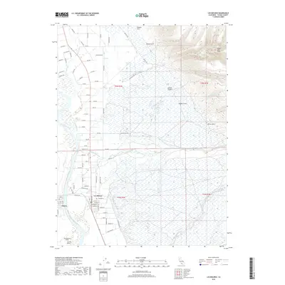
2018 Map of Los Molinos
USGS Topo · Published 2018About this map
Los Molinos and Téhama anchor this section of the Sacramento Valley, where the Sacramento River meanders through a landscape defined by its complex hydrology and agricultural grid. The map reveals the intricate network of watercourses feeding into the river, including Mill Creek, Elder Cr, and Antelope Cr. To the east, the terrain rises sharply from the valley floor toward Campo Seco Ridge, marked by deep drainages like Wildcat Canyon and Juniper Gulch. This interface between the flat Central Valley and the uplifted eastern ridges is crossed by numerous named thoroughfares such as Foothill Blvd and Dye Creek Ranch Rd. The settlement pattern follows a distinct north-south orientation along the river corridor, while the expansive wetlands of the Champlin Slough indicate the seasonal water movement that has shaped the history of Tehama County agriculture.
Find a feature on this map
88 named features on this map. Tap any name to fly to it.
Don’t see what you’re looking for? This feature index may not catch every label — zoom into the map to look around manually.
Map Details
Editions of this 2018 Los Molinos Map
This is the sole edition of this map. No revisions or reprints were ever made.
Other maps of this area

1886 · Lassen Peak
USGS Topo · 1:250,000

1890 · Red Bluff
USGS Topo · 1:250,000

1891 · Chico
USGS Topo · 1:125,000

1892 · Lassen Peak
USGS Topo · 1:250,000

1893 · Chico
USGS Topo · 1:125,000

1894 · Lassen Peak
USGS Topo · 1:250,000

1894 · Red Bluff
USGS Topo · 1:250,000

1895 · Chico
USGS Topo · 1:125,000

1904 · Vina
USGS Topo · 1:62,500

1905 · Tehama
USGS Topo · 1:62,500