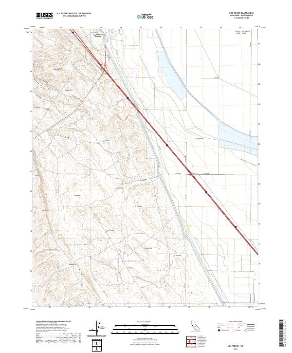
2021 Map of Los Viejos
USGS Topo · Published 2021About this map
The Kettleman Hills dominate this portion of the San Joaquin Valley, where the transition from the high-desert ridges to the irrigated valley floor is starkly visible. At the northern edge of this landscape sits Kettleman Station, a node in the regional infrastructure that supports the nearby oil fields and agricultural networks. The terrain is marked by numerous Spanish-named landmarks such as La Escudilla, La Lomica, and La Brecha, reflecting the deep cultural history of the ranching era in Kings County.
Find a feature on this map
45 named features on this map. Tap any name to fly to it.
Don’t see what you’re looking for? This feature index may not catch every label — zoom into the map to look around manually.
Map Details
Editions of this 2021 Los Viejos Map
This is the sole edition of this map. No revisions or reprints were ever made.
Other maps of this area

1912 · Coalinga
USGS Topo · 1:125,000

1914 · Lost Hills
USGS Topo · 1:125,000

1914 · Cholame
USGS Topo · 1:125,000

1915 · Cholame
USGS Topo · 1:125,000

1917 · Cholame
USGS Topo · 1:125,000

1930 · Discovery Well
USGS Topo · 1:31,680

1930 · Avenal Gap
USGS Topo · 1:31,680

1930 · Kettleman Plain
USGS Topo · 1:31,680

1930 · Middle Dome
USGS Topo · 1:31,680

1932 · Dudley Ridge
USGS Topo · 1:31,680