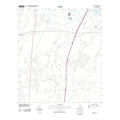
2010 Map of Losoya
USGS Topo · Published 2010About this map
Losoya and Thelma anchor this portion of Bexar County, where the hydrological convergence of the Medina River and the San Antonio River dictates the landscape. The northern edge of the map is defined by the expansive Victor Braunig Lake, a significant reservoir just downstream from the river junction. The area's aviation history is represented by small airfields like Triple R Airport and Russell Paradise Airport, which serve the rural communities outside of the primary San Antonio urban sprawl.
Find a feature on this map
45 named features on this map. Tap any name to fly to it.
Don’t see what you’re looking for? This feature index may not catch every label — zoom into the map to look around manually.
Map Details
Editions of this 2010 Losoya Map
This is the sole edition of this map. No revisions or reprints were ever made.
Other maps of this area

1953 · Terrell Wells
USGS Topo · 1:24,000

1953 · Elmendorf
USGS Topo · 1:24,000

1953 · Southton
USGS Topo · 1:24,000

1954 · San Antonio
USGS Topo · 1:250,000

1957 · San Antonio
USGS Topo · 1:250,000

1958 · Losoya
USGS Topo · 1:24,000

1958 · Thelma
USGS Topo · 1:24,000

1958 · Saspamco
USGS Topo · 1:24,000
1964 · Saspamco SE
USGS Topo · 1:24,000

1964 · Leming
USGS Topo · 1:24,000