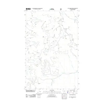
2011 Map of Lost Creek Divide
USGS Topo · Published 2011About this map
Lost Creek Divide and the surrounding Flathead County timberlands are defined by a complex network of forest development roads that trace the high ridges and deep drainages of the Stillwater State Forest area. This 2011 survey illustrates the modern management of this landscape, where routes like Natl Forest Develop Road 2942 Rd and Mountain Meadow Rd provide access to remote high-altitude features like Mountain Meadow and Reid Divide. The drainage patterns are clearly delineated, showing how water moves from the high country through Lost Creek, Big Lost Creek, and Cyclone Creek. The intricate contour work and labeled forest routes offer a precise look at the geography used by modern outdoorsmen and land managers, capturing the area before major modern fire or ecological shifts might have altered these specific access points and natural landmarks.
Find a feature on this map
19 named features on this map. Tap any name to fly to it.
Don’t see what you’re looking for? This feature index may not catch every label — zoom into the map to look around manually.
Map Details
Editions of this 2011 Lost Creek Divide Map
This is the sole edition of this map. No revisions or reprints were ever made.
Other maps of this area

1943 · Kalispell
USGS Topo · 1:125,000

1957 · Kalispell
USGS Topo · 1:250,000

1960 · Kalispell
USGS Topo · 1:250,000

1961 · Kalispell
USGS Topo · 1:250,000

1962 · Johnson Peak
USGS Topo · 1:24,000

1962 · Blue Grass Ridge
USGS Topo · 1:24,000

1962 · Beaver Lake
USGS Topo · 1:24,000

1962 · Lost Creek Divide
USGS Topo · 1:24,000

1962 · Ashley Mountain
USGS Topo · 1:24,000

1962 · Rhodes
USGS Topo · 1:24,000