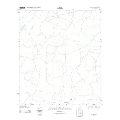
2012 Map of Lost Creek
USGS Topo · Published 2012About this map
Camp Billy Gibbons sits in the southern portion of this McCulloch County landscape, where the terrain is defined by a network of seasonal watercourses. The drainage patterns are dominated by the meandering path of Lost Cr, which flows centrally through the quadrangle, eventually meeting Brady Cr near the southern boundary. To the west, the Soil Conservation Service Site 1 Reservoir provides a primary point of water management in an area otherwise characterized by natural drainages like Plum Hollow and Honey Cr. This 2012 survey illustrates the contemporary rural infrastructure of the region, anchored by county routes such as Co Rd-236 and Co Rd-428 that navigate the creek-carved topography between the northern reaches of W Goens Cr and the larger southern tributaries.
Find a feature on this map
11 named features on this map. Tap any name to fly to it.
Don’t see what you’re looking for? This feature index may not catch every label — zoom into the map to look around manually.
Map Details
Editions of this 2012 Lost Creek Map
This is the sole edition of this map. No revisions or reprints were ever made.
Other maps of this area

1885 · San Saba
USGS Topo · 1:125,000

1894 · Brady
USGS Topo · 1:125,000

1894 · San Saba
USGS Topo · 1:125,000

1928 · Mercury
USGS Topo · 1:62,500

1930 · Richland Springs
USGS Topo · 1:62,500

1948 · Richland Springs
USGS Topo · 1:62,500

1950 · Mercury
USGS Topo · 1:62,500
1950 · Richland Springs
USGS Topo · 1:62,500

1954 · Brownwood
USGS Topo · 1:250,000
1955 · Brady Mountian
USGS Topo · 1:24,000