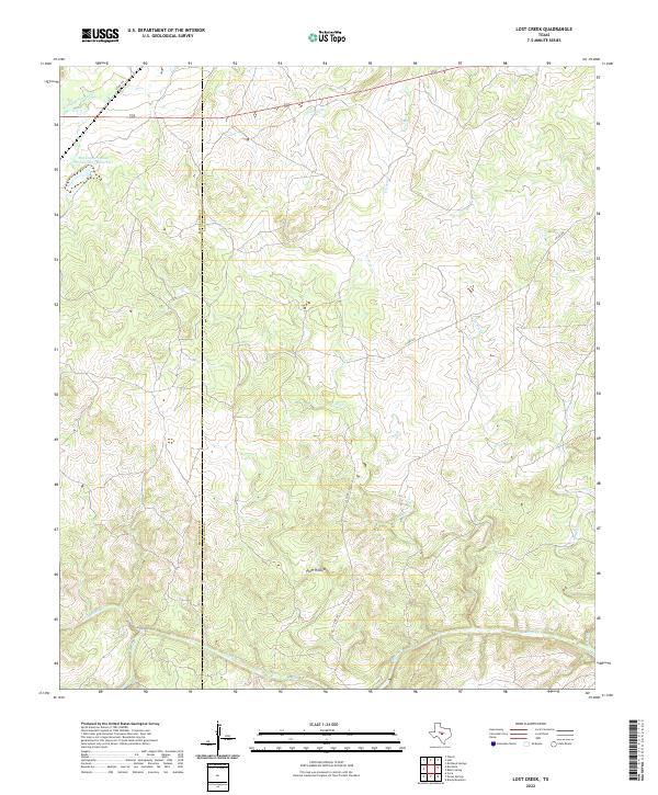
2022 Map of Lost Creek
USGS Topo · Published 2022About this map
The McCulloch and San Saba County line bisects this portion of the Texas Edwards Plateau, a landscape defined by an intricate network of seasonal drainage and creek beds. The drainage patterns of Brady Cr and Little Brady Cr dominate the southern reaches, while the northern terrain is carved by the headwaters of Richland Springs Cr and W Goens Cr. This 2022 survey illustrates a predominantly rural and agricultural environment where man-made features like the Soil Conservation Service Site 1 Reservoir represent modern water management efforts. Named topographical landmarks such as Plum Hollow and the winding course of Lost Cr provide specific geographical anchors for researchers examining local land use and hydrology along the county borders.
Find a feature on this map
13 named features on this map. Tap any name to fly to it.
Don’t see what you’re looking for? This feature index may not catch every label — zoom into the map to look around manually.
Map Details
Editions of this 2022 Lost Creek Map
This is the sole edition of this map. No revisions or reprints were ever made.
Other maps of this area

1885 · San Saba
USGS Topo · 1:125,000

1894 · Brady
USGS Topo · 1:125,000

1894 · San Saba
USGS Topo · 1:125,000

1928 · Mercury
USGS Topo · 1:62,500

1930 · Richland Springs
USGS Topo · 1:62,500

1948 · Richland Springs
USGS Topo · 1:62,500

1950 · Mercury
USGS Topo · 1:62,500
1950 · Richland Springs
USGS Topo · 1:62,500

1954 · Brownwood
USGS Topo · 1:250,000
1955 · Brady Mountian
USGS Topo · 1:24,000