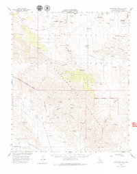
1958 Map of Lost Horse Mtn
USGS Topo · Published 1979About this map
Joshua Tree National Monument dominates this mid-century survey, revealing a landscape defined by its rugged desert hydrology and early mining history. The map records essential water sources for desert survival, including Stubbe Spring, Lost Horse Well, and the Pinyon Well (Site). Industrial activity is centered on the Lost Horse Mine and various shafts and mine dumps scattered through the high desert terrain.
Find a feature on this map
47 named features on this map. Tap any name to fly to it.
Don’t see what you’re looking for? This feature index may not catch every label — zoom into the map to look around manually.
Map Details
Editions of this 1958 Lost Horse Mtn Map
4 editions found
Other maps of this area

1904 · Indio
USGS Topo · 1:125,000

1940 · Cottonwood Spring
USGS Topo · 1:62,500

1941 · Toro Peak
USGS Topo · 1:62,500

1941 · Coachella
USGS Topo · 1:62,500

1941 · Edom
USGS Topo · 1:62,500

1942 · Amboy
USGS Topo · 1:250,000

1943 · Amboy
USGS Topo · 1:250,000

1943 · Coachella
USGS Topo · 1:62,500

1943 · Pinkham Well
USGS Topo · 1:62,500

1944 · Toro peak
USGS Topo · 1:62,500