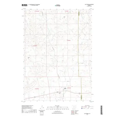
2017 Map of Lost Springs
USGS Topo · Published 2017About this map
Lost Springs serves as the primary focal point of this Eastern Wyoming landscape, situated along the southern edge of a vast drainage network. The topography is defined by the significant branching of Twentymile Cr and its tributaries, including E Fork Twentymile Cr and Dip Cr, which carve through the high plains. Historically significant for its status as one of the smallest incorporated towns in the United States, the town is anchored by its Po and proximity to the Converse Co Niobrara Co line.
Find a feature on this map
23 named features on this map. Tap any name to fly to it.
Don’t see what you’re looking for? This feature index may not catch every label — zoom into the map to look around manually.
Map Details
Editions of this 2017 Lost Springs Map
This is the sole edition of this map. No revisions or reprints were ever made.
Other maps of this area

1949 · Shawnee
USGS Topo · 1:24,000

1950 · Amend Ranch
USGS Topo · 1:24,000

1950 · Prairie View School
USGS Topo · 1:24,000

1950 · Shawnee
USGS Topo · 1:24,000

1954 · Torrington
USGS Topo · 1:250,000

1958 · Torrington
USGS Topo · 1:250,000
1961 · Shawnee
USGS Topo · 1:24,000

1970 · Lost Springs
USGS Topo · 1:24,000
1970 · The Park
USGS Topo · 1:24,000

1970 · Walker Creek School
USGS Topo · 1:24,000