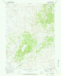
1970 Map of The Park
USGS Topo · Published 1973About this map
The Flat Top Oil and Gas Field dominates the northwest corner of this Wyoming landscape, where numerous Gas Wells and Drill Holes indicate a period of active energy exploration. An extensive Pipeline network cuts through the terrain, connecting industrial sites across the drainage basins of Twentymile Creek and the many branches of Shawnee Creek. This survey captures the transition from traditional ranching and transit to an extractive economy, evidenced by the presence of an Old Railroad Grade and a lonely Cemetery in the southeastern corner.
Find a feature on this map
24 named features on this map. Tap any name to fly to it.
Don’t see what you’re looking for? This feature index may not catch every label — zoom into the map to look around manually.
Map Details
Editions of this 1970 The Park Map
2 editions found
Other maps of this area

1949 · Shawnee
USGS Topo · 1:24,000

1949 · Orin
USGS Topo · 1:24,000

1950 · Amend Ranch
USGS Topo · 1:24,000

1950 · Orin
USGS Topo · 1:24,000

1950 · Shawnee
USGS Topo · 1:24,000

1954 · Torrington
USGS Topo · 1:250,000

1958 · Torrington
USGS Topo · 1:250,000
1961 · Shawnee
USGS Topo · 1:24,000

1970 · Lost Springs
USGS Topo · 1:24,000

1970 · Walker Creek School
USGS Topo · 1:24,000