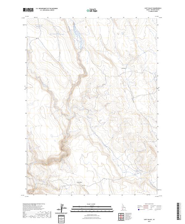
2023 Map of Lost Valley
USGS Topo · Published 2023About this map
The Owyhee River Wilderness and its protected waterways dominate the southwestern corner of this Idaho landscape. High desert hydrology is the primary story of this region, defined by the winding course of the Battle Creek Wild and Scenic River and its tributary, Blue Creek. The terrain is characterized by broad basins and depressions like Bull Basin and Lost Valley, punctuated by isolated features such as Dollar Butte. Human infrastructure is largely confined to water management and travel corridors, seen in the series of man-made structures including Dry Cr Reservoir Number Seven and Dry Cr Reservoir Number Four. These reservoirs, along with various localized water sources like Wildhorse Spring and Lost Valley Springs, reflect the critical importance of water rights and grazing resources in this remote section of Owyhee County. Connecting these disparate points is the primary thoroughfare of Battle Creek Rd.
Find a feature on this map
18 named features on this map. Tap any name to fly to it.
Don’t see what you’re looking for? This feature index may not catch every label — zoom into the map to look around manually.
Map Details
Editions of this 2023 Lost Valley Map
This is the sole edition of this map. No revisions or reprints were ever made.
Other maps of this area

1955 · Jordan Valley
USGS Topo · 1:250,000

1957 · Jordan Valley
USGS Topo · 1:250,000

1958 · Jordan Valley
USGS Topo · 1:250,000
1972 · Frying Pan Basin
USGS Topo · 1:24,000
1972 · Big Springs Ranch
USGS Topo · 1:24,000
1972 · Crab Spring Butte
USGS Topo · 1:24,000

1972 · Turner Table
USGS Topo · 1:24,000
1972 · Nichol Flat
USGS Topo · 1:24,000
1972 · Shoofly Springs
USGS Topo · 1:24,000
1972 · Sugarloaf
USGS Topo · 1:24,000