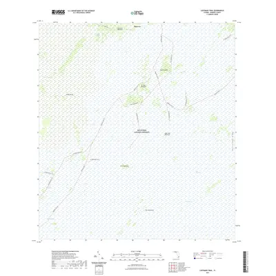
2021 Map of Lostmans Trail
USGS Topo · Published 2021About this map
Pinecrest sits at the northern edge of this wet, subtropical landscape, where the human footprint is defined by a sparse network of back-country trails and the historic Loop Road. The area is part of the Big Cypress National Preserve, a complex environment where slightly elevated hardwood hammocks rise above the expansive waters of The Everglades. These islands of biodiversity, such as Dr Tiger Hammock and Tamarind Hammock, provided critical high ground for early inhabitants and travelers navigating the slow-moving waters of Dayhoff Slough and East Slough. The intricate trail system, including the Red Bird Lane Trl and various utility-named tracks like Z4 Need Name 8 Trl, illustrates the ongoing effort to manage and traverse this seasonal wilderness. Features like Sandy Mound and Rattlesnake Ridge further distinguish the subtle topographic variations that dictate the ecology of the region.
Find a feature on this map
27 named features on this map. Tap any name to fly to it.
Don’t see what you’re looking for? This feature index may not catch every label — zoom into the map to look around manually.
Map Details
Editions of this 2021 Lostmans Trail Map
This is the sole edition of this map. No revisions or reprints were ever made.
Other maps of this area

1956 · Miami
USGS Topo · 1:250,000

1958 · Miami
USGS Topo · 1:250,000

1972 · Shark Valley Lookout Tower
USGS Topo · 1:24,000

1972 · Lostmans Trail
USGS Topo · 1:24,000

1972 · Big Boy Lake
USGS Topo · 1:24,000

1972 · Panther Mound
USGS Topo · 1:24,000

1972 · Indian Camp Creek
USGS Topo · 1:24,000

1973 · Fortymile Bend
USGS Topo · 1:24,000

1973 · Fiftymile Bend
USGS Topo · 1:24,000

1973 · Monroe Station
USGS Topo · 1:24,000