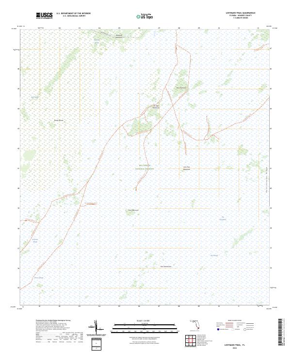
2024 Map of Lostmans Trail
USGS Topo · Published 2024About this map
Big Cypress National Preserve defines this landscape of the southwestern Florida interior, where the eastern reaches of the quadrangle transition into the sawgrass expanses of The Everglades. The terrain is characterized by a series of hammock islands and sloughs that dictate the movement of water and travelers alike. Named high points and vegetation islands such as Tamarind Hammock, Hess Hammock, and Dr Tiger Hammock provide the only relief in a saturated environment dominated by Dayhoff Slough and Gum Slough.
Find a feature on this map
25 named features on this map. Tap any name to fly to it.
Don’t see what you’re looking for? This feature index may not catch every label — zoom into the map to look around manually.
Map Details
Editions of this 2024 Lostmans Trail Map
This is the sole edition of this map. No revisions or reprints were ever made.
Other maps of this area

1956 · Miami
USGS Topo · 1:250,000

1958 · Miami
USGS Topo · 1:250,000

1972 · Shark Valley Lookout Tower
USGS Topo · 1:24,000

1972 · Lostmans Trail
USGS Topo · 1:24,000

1972 · Big Boy Lake
USGS Topo · 1:24,000

1972 · Panther Mound
USGS Topo · 1:24,000

1972 · Indian Camp Creek
USGS Topo · 1:24,000

1973 · Fortymile Bend
USGS Topo · 1:24,000

1973 · Fiftymile Bend
USGS Topo · 1:24,000

1973 · Monroe Station
USGS Topo · 1:24,000