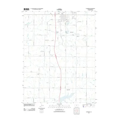
2012 Map of Louisburg
USGS Topo · Published 2012About this map
Louisburg serves as the primary hub of this eastern Kansas landscape, with its residential grid extending southward toward Louisburg Lake. The surrounding Miami County countryside is defined by the drainage basins of S Wea Cr and Rabbit Cr, where the terrain rises toward Metcalf Ridge. This survey is particularly rich for genealogical research, documenting numerous family-named burial sites including the Cashman Cem, Wilson - Raymer Cem, and Herman Cem, alongside larger community grounds like Saint Mary's Cem. Education and transit patterns are visible through the locations of the Spring Valley School and Baxter School, as well as small aviation nodes at Crosswind Airfield and Somerset Airport. The southern reaches are characterized by recreational and rural features, notably the Rutlader Outpost Camping Facility and the Metcalf Ridge Country Course, showing the area's development into a mix of agricultural and leisure use by the early 21st century.
Find a feature on this map
66 named features on this map. Tap any name to fly to it.
Don’t see what you’re looking for? This feature index may not catch every label — zoom into the map to look around manually.
Map Details
Editions of this 2012 Louisburg Map
This is the sole edition of this map. No revisions or reprints were ever made.
Other maps of this area

1887 · Olathe
USGS Topo · 1:125,000

1887 · Mound City
USGS Topo · 1:125,000

1893 · Mound City
USGS Topo · 1:125,000

1893 · Olathe
USGS Topo · 1:125,000

1947 · Lawrence
USGS Topo · 1:250,000

1950 · Lawrence
USGS Topo · 1:250,000

1953 · Freeman
USGS Topo · 1:24,000

1953 · West Line
USGS Topo · 1:24,000

1956 · Bucyrus
USGS Topo · 1:24,000

1956 · Paola East
USGS Topo · 1:24,000