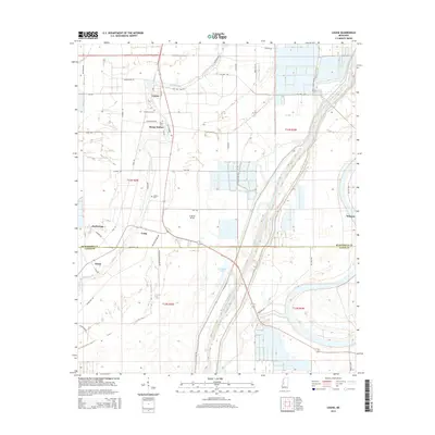
2015 Map of Louise
USGS Topo · Published 2015About this map
The town of Louise serves as the central hub for this rural stretch of the Mississippi Delta, situated along the meandering path of Silver Creek. The landscape is defined by its sophisticated water management systems, notably the massive Will M Whittington Auxiliary Channel and the W Levee Rd that runs parallel to it, protecting the surrounding agricultural lands. Small communities such as Sleepy Hollow, Anchorage, and Patosi are connected by a network of local routes like Old Highway and Seven Mile Rd, reflecting the region's historic transportation patterns. For local historians, several small burial sites like Huddleston Cem and Goshen Cem provide important genealogical markers across the Humphreys and Yazoo County line. The presence of Five Mile Lake and the Trn Wr wildlife area illustrates the persistence of natural wetlands amidst the engineered drainage basins and sprawling fields.
Find a feature on this map
49 named features on this map. Tap any name to fly to it.
Don’t see what you’re looking for? This feature index may not catch every label — zoom into the map to look around manually.
Map Details
Editions of this 2015 Louise Map
This is the sole edition of this map. No revisions or reprints were ever made.
Other maps of this area

1940 · Auter
USGS Topo · 1:62,500

1940 · Mileston
USGS Topo · 1:62,500

1953 · Greenwood
USGS Topo · 1:250,000

1954 · Mileston
USGS Topo · 1:62,500

1955 · Jackson
USGS Topo · 1:250,000

1956 · Greenwood
USGS Topo · 1:250,000

1961 · Jackson
USGS Topo · 1:250,000

1961 · Bayland
USGS Topo · 1:62,500

1961 · Valley
USGS Topo · 1:62,500

1962 · Jackson
USGS Topo · 1:250,000