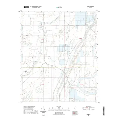
2020 Map of Louise
USGS Topo · Published 2020About this map
Louise sits at the heart of this Delta landscape, where the flat agricultural terrain is defined by a complex network of drainage and flood control infrastructure. The most prominent man-made feature is the massive Will M Whittington Auxiliary Channel, which runs north-to-south alongside the natural course of Silver Creek. These waterways dictate the local geography, separating the clustered settlements of Anchorage, Craig, and Potosi. Genealogists will find several notable burial sites including Huddleston Cem, Balup Cem, and Goshen Cem, which are tucked between the vast fields and local routes like Mount Zion Cir. The road names themselves reflect the local character and history of the region, from the evocative Blue Ruin Rd and Good Luck Rd to the functional Old Five Mile Rd. Crossing the boundary between Humphreys and Yazoo counties, this survey documents the modern state of a region long shaped by its relationship with the water.
Find a feature on this map
52 named features on this map. Tap any name to fly to it.
Don’t see what you’re looking for? This feature index may not catch every label — zoom into the map to look around manually.
Map Details
Editions of this 2020 Louise Map
This is the sole edition of this map. No revisions or reprints were ever made.
Other maps of this area

1940 · Auter
USGS Topo · 1:62,500

1940 · Mileston
USGS Topo · 1:62,500

1953 · Greenwood
USGS Topo · 1:250,000

1954 · Mileston
USGS Topo · 1:62,500

1955 · Jackson
USGS Topo · 1:250,000

1956 · Greenwood
USGS Topo · 1:250,000

1961 · Jackson
USGS Topo · 1:250,000

1961 · Bayland
USGS Topo · 1:62,500

1961 · Valley
USGS Topo · 1:62,500

1962 · Jackson
USGS Topo · 1:250,000