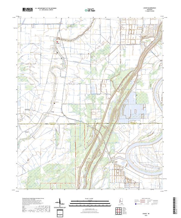
2024 Map of Louise
USGS Topo · Published 2024About this map
Louise stands at the northern edge of this landscape, where the agricultural plains of the Mississippi Delta meet vast protected wetlands. The territory is defined by complex water management, most notably the Will M Whittington Auxiliary Channel and the winding course of Silver Creek. These waterways provide the backbone for a region dominated by the Panther Swamp National Wildlife Refuge and the Theodore Roosevelt National Wildlife Refuge. Small settlements and named locales like Anchorage, Craig, and Patosi are connected by a network of rural roads such as Old Hwy 49 and Co Barn Rd. Family history is preserved at local burial sites including Huddleston Cem, Balup Cem, and Goshen Cem, which sit among the expansive fields and bayous that characterize the Humphreys and Yazoo county line.
Find a feature on this map
53 named features on this map. Tap any name to fly to it.
Don’t see what you’re looking for? This feature index may not catch every label — zoom into the map to look around manually.
Map Details
Editions of this 2024 Louise Map
This is the sole edition of this map. No revisions or reprints were ever made.
Other maps of this area

1940 · Auter
USGS Topo · 1:62,500

1940 · Mileston
USGS Topo · 1:62,500

1953 · Greenwood
USGS Topo · 1:250,000

1954 · Mileston
USGS Topo · 1:62,500

1955 · Jackson
USGS Topo · 1:250,000

1956 · Greenwood
USGS Topo · 1:250,000

1961 · Jackson
USGS Topo · 1:250,000

1961 · Bayland
USGS Topo · 1:62,500

1961 · Valley
USGS Topo · 1:62,500

1962 · Jackson
USGS Topo · 1:250,000