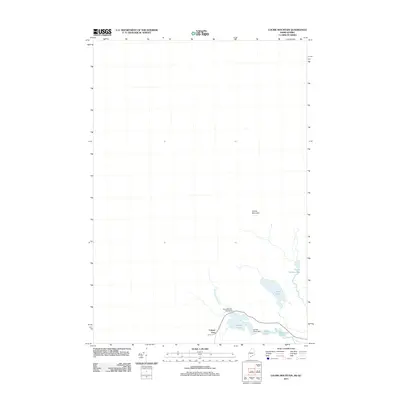
2011 Map of Louise Mountain
USGS Topo · Published 2011About this map
Coburn Gore sits along the international boundary in this 2011 survey, marking a sparsely settled landscape where the high ground of Louise Mountain overlooks a complex network of waterways. The geography is defined by a series of ponds and engineering features that manage the flow of water across the border region, including the Arnold Pond Dam and the Arnold Pond Inlet Dam on Arnold Pond. Further north and east, the terrain becomes increasingly marshy, as evidenced by Upper Nathan Bog and the secluded waters of Crosby Pond. This map details a specialized border environment where local hydrology, represented by Horseshoe Stream and Horseshoe Pond, dictates the layout of the few existing roads and clearings in this northern Maine and Quebec interface.
Find a feature on this map
11 named features on this map. Tap any name to fly to it.
Don’t see what you’re looking for? This feature index may not catch every label — zoom into the map to look around manually.
Map Details
Editions of this 2011 Louise Mountain Map
This is the sole edition of this map. No revisions or reprints were ever made.
Other maps of this area

1928 · Chain Lakes
USGS Topo · 1:48,000

1928 · Skinner
USGS Topo · 1:48,000

1931 · Skinner
USGS Topo · 1:62,500

1932 · Arnold Pond
USGS Topo · 1:48,000

1932 · Chain Lakes
USGS Topo · 1:62,500

1935 · Chain Lakes
USGS Topo · 1:62,500

1935 · Arnold Pond
USGS Topo · 1:62,500

1949 · Jackman
USGS Topo · 1:250,000
1951 · Chain Lakes
USGS Topo · 1:50,000

1963 · Jackman
USGS Topo · 1:250,000