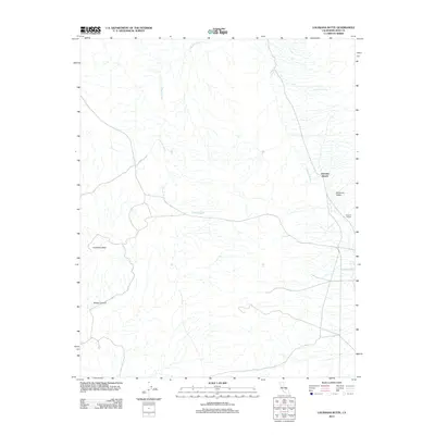
2012 Map of Louisiana Butte
USGS Topo · Published 2012About this map
Darwin Wash and Junction Wash dominate this arid landscape in eastern California, where water remains the most precious and localized resource. The presence of Tennessee Spring and Carricut Lake highlights the precarious nature of life in these basins, where traditional ranching outposts like Junction Ranch and Howard Ranch took root. The geography is defined by broad depressions such as Etcharren Valley and the sharp rising heights of Louisiana Butte and the walls of Sheep Canyon. This USGS survey illustrates the modern road network and land use patterns of Inyo County at the start of the 21st century, showing how infrastructure follows the natural drainage lines of the high desert terrain.
Find a feature on this map
9 named features on this map. Tap any name to fly to it.
Don’t see what you’re looking for? This feature index may not catch every label — zoom into the map to look around manually.
Map Details
Editions of this 2012 Louisiana Butte Map
This is the sole edition of this map. No revisions or reprints were ever made.
Other maps of this area

1908 · Ballarat
USGS Topo · 1:250,000

1913 · Ballarat
USGS Topo · 1:250,000

1915 · Searles Lake
USGS Topo · 1:250,000

1947 · Trona
USGS Topo · 1:250,000

1948 · Trona
USGS Topo · 1:250,000

1948 · Death Valley
USGS Topo · 1:250,000

1949 · Trona
USGS Topo · 1:62,500

1950 · Trona
USGS Topo · 1:62,500

1951 · Maturango Peak
USGS Topo · 1:62,500

1951 · Coso Peak
USGS Topo · 1:62,500