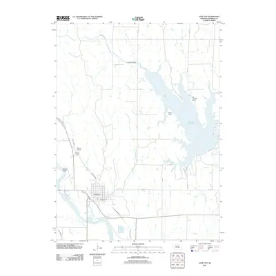
2011 Map of Loup City
USGS Topo · Published 2011About this map
Loup City sits at the intersection of a complex water management system and the natural winding path of the Middle Loup River. This 2011 survey illustrates the significant local reliance on irrigation and water storage, dominated by the massive Sherman Reservoir to the northeast. The reservoir's shoreline is defined by distinct features such as Shaughnessy Bay, Muddy Point, and Big Thunder Island, with recreational and residential access through the Thunder Bay Area and Redwood Area.
Find a feature on this map
35 named features on this map. Tap any name to fly to it.
Don’t see what you’re looking for? This feature index may not catch every label — zoom into the map to look around manually.
Map Details
Editions of this 2011 Loup City Map
This is the sole edition of this map. No revisions or reprints were ever made.
Other maps of this area

1899 · Loup
USGS Topo · 1:125,000

1951 · Arcadia SE
USGS Topo · 1:24,000

1951 · Litchfield NE
USGS Topo · 1:24,000

1951 · Arcadia East
USGS Topo · 1:24,000

1953 · Loup City NW
USGS Topo · 1:24,000

1953 · North Loup
USGS Topo · 1:24,000

1953 · Ravenna NW
USGS Topo · 1:24,000

1953 · Loup City SE
USGS Topo · 1:24,000

1953 · Loup City
USGS Topo · 1:24,000

1953 · Ashton
USGS Topo · 1:24,000