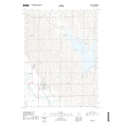
2017 Map of Loup City
USGS Topo · Published 2017About this map
Loup City serves as the focal point of this Sherman County landscape, situated along the northern banks of the Middle Loup River. The town's grid is detailed down to specific streets such as N 8th St and S 12th St, while the local aviation needs are met by the Loup City Municipal Airport to the northwest. For genealogists, the map identifies local burial grounds including Evergreen Cem and Saint Josephats Cem, providing essential points of reference for family history research in the Platte River valley region.
Find a feature on this map
50 named features on this map. Tap any name to fly to it.
Don’t see what you’re looking for? This feature index may not catch every label — zoom into the map to look around manually.
Map Details
Editions of this 2017 Loup City Map
This is the sole edition of this map. No revisions or reprints were ever made.
Other maps of this area

1899 · Loup
USGS Topo · 1:125,000

1951 · Arcadia SE
USGS Topo · 1:24,000

1951 · Litchfield NE
USGS Topo · 1:24,000

1951 · Arcadia East
USGS Topo · 1:24,000

1953 · Loup City NW
USGS Topo · 1:24,000

1953 · North Loup
USGS Topo · 1:24,000

1953 · Ravenna NW
USGS Topo · 1:24,000

1953 · Loup City SE
USGS Topo · 1:24,000

1953 · Loup City
USGS Topo · 1:24,000

1953 · Ashton
USGS Topo · 1:24,000