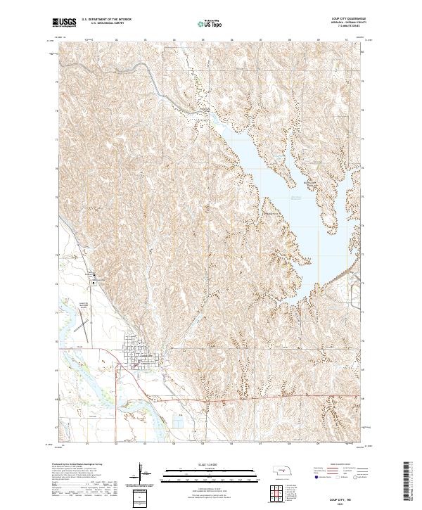
2021 Map of Loup City
USGS Topo · Published 2021About this map
Loup City serves as the focal point of this Sherman County landscape, situated along the meandering course of the Middle Loup River. The town's grid is anchored by the Sherman County Courthouse, while its local history is preserved at Saint Josephats Cem and Evergreen Cem to the northwest. To the east, the terrain is dominated by the sprawling waters of the Sherman Reservoir, which features notable points of interest such as Big Thunder Island and Shaughnessy Bay. The hydrography of the region is defined by a network of smaller tributaries including Dead Horse Cr, Oak Cr, and Cob Cr, which cut through the drainage basins surrounding the river. Land use and infrastructure are evident through the Loup City Municipal Airport and a detailed road network that includes Old Hwy 92 and the Fishermans Bridge crossing, illustrating the modern connectivity of this central Nebraska agricultural and recreational hub.
Find a feature on this map
36 named features on this map. Tap any name to fly to it.
Don’t see what you’re looking for? This feature index may not catch every label — zoom into the map to look around manually.
Map Details
Editions of this 2021 Loup City Map
This is the sole edition of this map. No revisions or reprints were ever made.
Other maps of this area

1899 · Loup
USGS Topo · 1:125,000

1951 · Arcadia SE
USGS Topo · 1:24,000

1951 · Litchfield NE
USGS Topo · 1:24,000

1951 · Arcadia East
USGS Topo · 1:24,000

1953 · Loup City NW
USGS Topo · 1:24,000

1953 · North Loup
USGS Topo · 1:24,000

1953 · Ravenna NW
USGS Topo · 1:24,000

1953 · Loup City SE
USGS Topo · 1:24,000

1953 · Loup City
USGS Topo · 1:24,000

1953 · Ashton
USGS Topo · 1:24,000