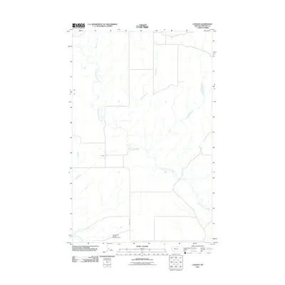
2011 Map of Lovejoy
USGS Topo · Published 2011About this map
Lovejoy is the primary settlement in this sparsely populated stretch of Phillips County, Montana, situated in a landscape defined by the winding course of Little Cottonwood Creek. The creek meanders across the map from northwest to southeast, joined in the lower corner by Cottonwood Creek. Human impact on the terrain is focused on water management and grazing, evidenced by the Cottonwood Grazing Number 4 Dam located in the southern reaches of the quadrangle. Aside from the small cluster at Lovejoy, the area is serviced by a limited road network, including the prominent Fanning Hill Rd which traverses the lower terrain. The map depicts a late-period ranching environment where large-scale land use and watershed features are the primary landmarks for local navigation and land management.
Find a feature on this map
5 named features on this map. Tap any name to fly to it.
Don’t see what you’re looking for? This feature index may not catch every label — zoom into the map to look around manually.
Map Details
Editions of this 2011 Lovejoy Map
This is the sole edition of this map. No revisions or reprints were ever made.
Other maps of this area

1920 · Avery
USGS Topo · 1:125,000

1920 · Cowan
USGS Topo · 1:125,000

1953 · Havre
USGS Topo · 1:250,000

1954 · Glasgow
USGS Topo · 1:250,000

1957 · Glasgow
USGS Topo · 1:250,000

1957 · Havre
USGS Topo · 1:250,000

1958 · Glasgow
USGS Topo · 1:250,000

1958 · Havre
USGS Topo · 1:250,000
1984 · Garland Creek
USGS Topo · 1:24,000

1984 · Austin Coulee
USGS Topo · 1:24,000