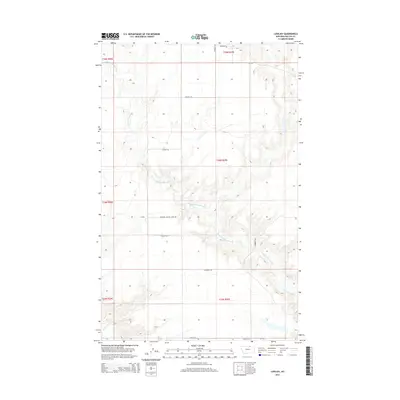
2014 Map of Lovejoy
USGS Topo · Published 2014About this map
Lovejoy sits within the wide, dissected plains of Phillips County, where the landscape is defined by the winding course of Little Cottonwood Cr. This 2014 survey captures a rural Montana environment where township lines and remote access roads provide the primary structure for land use and navigation. The drainage patterns of the creek and its numerous unnamed tributaries illustrate the complex topography of the Missouri Plateau region. A handful of local routes, including Lovejoy Rd and Hammond Rd, connect the scattered holdings of this ranching and hunting country. The presence of Simonson Hunting Cabin Dr indicates the seasonal and recreational significance of the area, while the underlying Public Land Survey System grid highlights the enduring legal framework of the Western frontier.
Find a feature on this map
13 named features on this map. Tap any name to fly to it.
Don’t see what you’re looking for? This feature index may not catch every label — zoom into the map to look around manually.
Map Details
Editions of this 2014 Lovejoy Map
This is the sole edition of this map. No revisions or reprints were ever made.
Other maps of this area

1920 · Avery
USGS Topo · 1:125,000

1920 · Cowan
USGS Topo · 1:125,000

1953 · Havre
USGS Topo · 1:250,000

1954 · Glasgow
USGS Topo · 1:250,000

1957 · Glasgow
USGS Topo · 1:250,000

1957 · Havre
USGS Topo · 1:250,000

1958 · Glasgow
USGS Topo · 1:250,000

1958 · Havre
USGS Topo · 1:250,000
1984 · Garland Creek
USGS Topo · 1:24,000

1984 · Austin Coulee
USGS Topo · 1:24,000