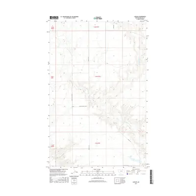
2017 Map of Lovejoy
USGS Topo · Published 2017About this map
Lovejoy sits at the heart of this high plains landscape in Phillips County, Montana, providing a look at the rural cattle and hunting grounds of the northern frontier. The terrain is defined by the winding path of Little Cottonwood Cr, which cuts through the coulees and draws that dominate the local topography. This 2017 survey illustrates a modern ranching environment where access is governed by a sparse network of gravel and dirt routes, such as Fanning Hill/Lovejoy Rd and Hammond Rd.
Find a feature on this map
14 named features on this map. Tap any name to fly to it.
Don’t see what you’re looking for? This feature index may not catch every label — zoom into the map to look around manually.
Map Details
Editions of this 2017 Lovejoy Map
This is the sole edition of this map. No revisions or reprints were ever made.
Other maps of this area

1920 · Avery
USGS Topo · 1:125,000

1920 · Cowan
USGS Topo · 1:125,000

1953 · Havre
USGS Topo · 1:250,000

1954 · Glasgow
USGS Topo · 1:250,000

1957 · Glasgow
USGS Topo · 1:250,000

1957 · Havre
USGS Topo · 1:250,000

1958 · Glasgow
USGS Topo · 1:250,000

1958 · Havre
USGS Topo · 1:250,000
1984 · Garland Creek
USGS Topo · 1:24,000

1984 · Austin Coulee
USGS Topo · 1:24,000