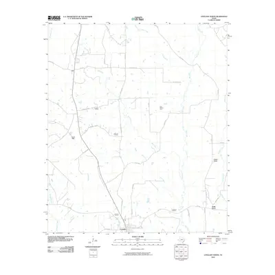
2010 Map of Lovelady North
USGS Topo · Published 2010About this map
Lovelady serves as the primary anchor for this rural Texas landscape, where the town's northern reaches give way to a network of creeks and localized family landmarks. The mapping reflects a traditional East Texas settlement pattern, characterized by scattered rural communities like Smith Grove, Center Grove, and the small crossroads at Cut. Numerous burial grounds, including Evergreen Cemetery, Rockland Cemetery, and the Center Hill Cemetery, provide significant data for genealogists tracing families in this corner of Houston County. Waterways such as Hartts Creek, Box Creek, and Gail Creek define the drainage of the area, punctuated by the Clay Fulcher Dam. The road network, composed of routes like Fodice Rd and Rockland Cem Rd, links these remote homesteads and centers of local history.
Find a feature on this map
41 named features on this map. Tap any name to fly to it.
Don’t see what you’re looking for? This feature index may not catch every label — zoom into the map to look around manually.
Map Details
Editions of this 2010 Lovelady North Map
This is the sole edition of this map. No revisions or reprints were ever made.
Other maps of this area

1950 · Crockett
USGS Topo · 1:24,000

1951 · Crockett
USGS Topo · 1:24,000

1951 · Berea
USGS Topo · 1:24,000

1953 · Palestine
USGS Topo · 1:250,000

1957 · Palestine
USGS Topo · 1:250,000

1962 · Lovelady South
USGS Topo · 1:24,000

1962 · Glendale
USGS Topo · 1:24,000

1963 · Lovelady North
USGS Topo · 1:24,000
1963 · Fodice
USGS Topo · 1:24,000

1964 · Porter Springs
USGS Topo · 1:24,000