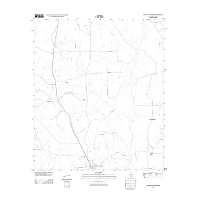
2013 Map of Lovelady North
USGS Topo · Published 2013About this map
The town of Lovelady serves as the southern anchor for this Houston County landscape, where small crossroads communities and family cemeteries punctuate the rural terrain. Long-established settlements like Lone Pine and Cut are connected by a network of farm roads, including F-M 231 and Shilo RD. The map reveals a high concentration of burial grounds such as Evergreen Cem and Cal Wooten Cem, which provide significant value for genealogists tracing family roots in this corner of East Texas.
Find a feature on this map
43 named features on this map. Tap any name to fly to it.
Don’t see what you’re looking for? This feature index may not catch every label — zoom into the map to look around manually.
Map Details
Editions of this 2013 Lovelady North Map
This is the sole edition of this map. No revisions or reprints were ever made.
Other maps of this area

1950 · Crockett
USGS Topo · 1:24,000

1951 · Crockett
USGS Topo · 1:24,000

1951 · Berea
USGS Topo · 1:24,000

1953 · Palestine
USGS Topo · 1:250,000

1957 · Palestine
USGS Topo · 1:250,000

1962 · Lovelady South
USGS Topo · 1:24,000

1962 · Glendale
USGS Topo · 1:24,000

1963 · Lovelady North
USGS Topo · 1:24,000
1963 · Fodice
USGS Topo · 1:24,000

1964 · Porter Springs
USGS Topo · 1:24,000