
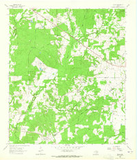
1963 Map of Lovelady North
USGS Topo · Published 1964About this map
The town of Lovelady serves as the focal point of this 1963 survey, situated along the Missouri Pacific railroad line that cuts through the western portion of the quadrangle. This area of Houston County is characterized by a network of drainage systems, including Box Creek, Gail Creek, and Tantabogue Creek, which define the undulating landscape between agricultural clearings and wooded patches. The distribution of rural landmarks like Anderson Chapel, South Hillside Ch, and the Center Grove Sch suggests a community structure built around dispersed family farms and local congregations.
Find a feature on this map
24 named features on this map. Tap any name to fly to it.
Don’t see what you’re looking for? This feature index may not catch every label — zoom into the map to look around manually.
Map Details
Editions of this 1963 Lovelady North Map
This is the sole edition of this map. No revisions or reprints were ever made.
Other maps of this area

1950 · Crockett
USGS Topo · 1:24,000

1951 · Crockett
USGS Topo · 1:24,000

1951 · Berea
USGS Topo · 1:24,000

1953 · Palestine
USGS Topo · 1:250,000

1957 · Palestine
USGS Topo · 1:250,000

1962 · Lovelady South
USGS Topo · 1:24,000

1962 · Glendale
USGS Topo · 1:24,000
1963 · Fodice
USGS Topo · 1:24,000

1964 · Porter Springs
USGS Topo · 1:24,000

1964 · Pearsons Chapel
USGS Topo · 1:24,000