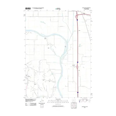
2010 Map of Loveland
USGS Topo · Published 2010About this map
The Missouri River carves a winding path through the borderlands of Iowa and Nebraska, defining a landscape of river bends and small valley settlements. Along its eastern banks, the communities of Loveland, Willow, and Grable sit near the base of the loess hills, while the river's hydrology is marked by features like Lower Calhoun Bend and Boyer Bend. The western side of the river features the town of Nashville, situated near Exley Dam.
Find a feature on this map
34 named features on this map. Tap any name to fly to it.
Don’t see what you’re looking for? This feature index may not catch every label — zoom into the map to look around manually.
Map Details
Editions of this 2010 Loveland Map
This is the sole edition of this map. No revisions or reprints were ever made.
Other maps of this area

1893 · Omaha
USGS Topo · 1:62,500

1893 · Fremont
USGS Topo · 1:125,000

1896 · Fremont
USGS Topo · 1:125,000

1954 · Omaha
USGS Topo · 1:250,000

1955 · Fremont
USGS Topo · 1:250,000

1956 · Irvington
USGS Topo · 1:24,000

1956 · Council Bluffs North
USGS Topo · 1:24,000

1956 · Omaha North
USGS Topo · 1:24,000

1957 · Fremont
USGS Topo · 1:250,000

1957 · Omaha
USGS Topo · 1:250,000