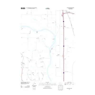
2013 Map of Loveland
USGS Topo · Published 2013About this map
Boyer River and the complex waterways of Boyer Chute dominate this landscape along the Iowa and Nebraska border. The map documents a corridor of small settlements and transit infrastructure, including the communities of Loveland and Nashville. The influence of the Missouri River is evident in the geomorphology of Lower Calhoun Bend and Boyer Bend, which shape the local road network and land use patterns. Transportation history is anchored by the Old Lincoln Hwy on the eastern side of the quadrangle, running parallel to modern transit routes. Local landmarks such as Heaton Airport and Honey Creek Campground are situated among a network of rural roads with family-inspired names like Davis Mountain Rd and Edith Marie Ave. Small-scale water features like Exley Reservoir and Ponca Cr provide further detail for those tracing the environmental history of the Missouri River valley.
Find a feature on this map
66 named features on this map. Tap any name to fly to it.
Don’t see what you’re looking for? This feature index may not catch every label — zoom into the map to look around manually.
Map Details
Editions of this 2013 Loveland Map
This is the sole edition of this map. No revisions or reprints were ever made.
Other maps of this area

1893 · Omaha
USGS Topo · 1:62,500

1893 · Fremont
USGS Topo · 1:125,000

1896 · Fremont
USGS Topo · 1:125,000

1954 · Omaha
USGS Topo · 1:250,000

1955 · Fremont
USGS Topo · 1:250,000

1956 · Irvington
USGS Topo · 1:24,000

1956 · Council Bluffs North
USGS Topo · 1:24,000

1956 · Omaha North
USGS Topo · 1:24,000

1957 · Fremont
USGS Topo · 1:250,000

1957 · Omaha
USGS Topo · 1:250,000