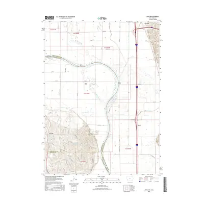
2015 Map of Loveland
USGS Topo · Published 2015About this map
The Missouri River meanders through the heart of this landscape, defining the state boundary between Iowa and Nebraska. This 2015 survey reveals the intricate water management and agricultural patterns of the river valley, where the Boyer River and Boyer Chute parallel the main channel near Lower Calhoun Bend. On the Nebraska side, the hills rise sharply above the floodplain, dotted with private water features such as Jungbluth Reservoir and Exley Reservoir. Small settlements like Loveland and Nashville anchor the local road network, while Ascot sits near the interstate corridor. For those researching local burial sites, the Shipley Cem is located on the western bluffs. The geography is further marked by legacy infrastructure like the Old Lincoln Hwy and the private Heaton Airport, illustrating the continued importance of transport in this river-bottom region.
Find a feature on this map
55 named features on this map. Tap any name to fly to it.
Don’t see what you’re looking for? This feature index may not catch every label — zoom into the map to look around manually.
Map Details
Editions of this 2015 Loveland Map
This is the sole edition of this map. No revisions or reprints were ever made.
Other maps of this area

1893 · Omaha
USGS Topo · 1:62,500

1893 · Fremont
USGS Topo · 1:125,000

1896 · Fremont
USGS Topo · 1:125,000

1954 · Omaha
USGS Topo · 1:250,000

1955 · Fremont
USGS Topo · 1:250,000

1956 · Irvington
USGS Topo · 1:24,000

1956 · Council Bluffs North
USGS Topo · 1:24,000

1956 · Omaha North
USGS Topo · 1:24,000

1957 · Fremont
USGS Topo · 1:250,000

1957 · Omaha
USGS Topo · 1:250,000