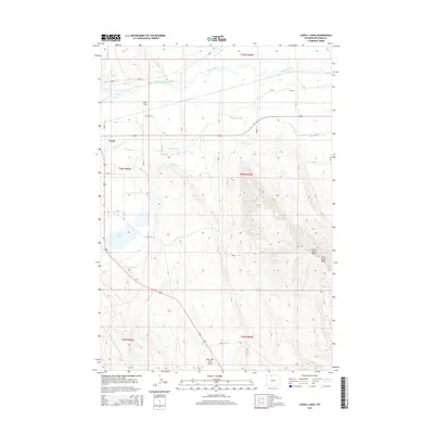
2015 Map of Lovell Lakes
USGS Topo · Published 2015About this map
The Shoshone River flows through this Big Horn County landscape, where an intricate network of man-made waterways supports the region's agricultural life. The map reveals the vital role of the Big Fork Canal, Sunlight Canal, and Lovell Canal in directing water across the terrain south of Lovell. This irrigation infrastructure is a defining characteristic of the area, etched into the land alongside natural drainages like Dry Cr and Sand Draw.
Find a feature on this map
40 named features on this map. Tap any name to fly to it.
Don’t see what you’re looking for? This feature index may not catch every label — zoom into the map to look around manually.
Map Details
Editions of this 2015 Lovell Lakes Map
This is the sole edition of this map. No revisions or reprints were ever made.
Other maps of this area

1955 · Cody
USGS Topo · 1:250,000

1958 · Cody
USGS Topo · 1:250,000

1962 · Cody
USGS Topo · 1:250,000

1964 · Kane
USGS Topo · 1:24,000

1964 · Lovell Lakes
USGS Topo · 1:24,000

1964 · Sykes Spring
USGS Topo · 1:24,000
1964 · Natural Trap Cave
USGS Topo · 1:24,000

1966 · North Emblem Reservoir
USGS Topo · 1:24,000

1966 · Cowley
USGS Topo · 1:24,000

1966 · Jack Horner Reservoir
USGS Topo · 1:24,000