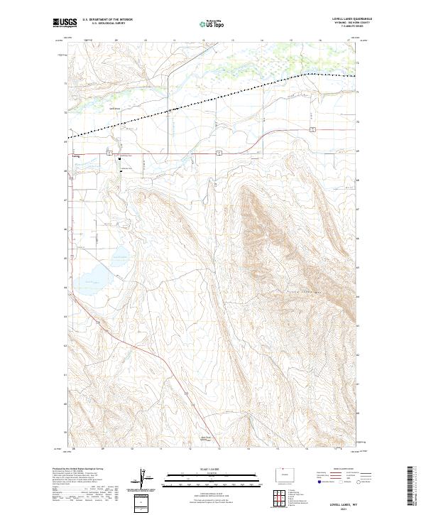
2021 Map of Lovell Lakes
USGS Topo · Published 2021About this map
The Shoshone River corridor in Big Horn County reveals a landscape shaped by intensive water management and irrigation engineering. The complexity of the local agricultural infrastructure is evident in the network of waterways including the Sunlight Canal, Lovell Canal, Globe Canal, and the Hunt Godfrey Canal, all of which divert water across the plains south of the river. The town of Lovell serves as the primary hub, situated near where the river meets the dry, northern foothills of Little Sheep Mtn. Genealogists and local historians can locate the Sand Draw Cem and Lutheran Cem, both positioned near the Sand Draw drainage. South of the main settlement, the namesake Lovell Lakes occupy a prominent depression, while features like the Hooker Drain further illustrate the region's historical reliance on managed water systems to sustain its development.
Find a feature on this map
45 named features on this map. Tap any name to fly to it.
Don’t see what you’re looking for? This feature index may not catch every label — zoom into the map to look around manually.
Map Details
Editions of this 2021 Lovell Lakes Map
This is the sole edition of this map. No revisions or reprints were ever made.
Other maps of this area

1955 · Cody
USGS Topo · 1:250,000

1958 · Cody
USGS Topo · 1:250,000

1962 · Cody
USGS Topo · 1:250,000

1964 · Kane
USGS Topo · 1:24,000

1964 · Lovell Lakes
USGS Topo · 1:24,000

1964 · Sykes Spring
USGS Topo · 1:24,000
1964 · Natural Trap Cave
USGS Topo · 1:24,000

1966 · North Emblem Reservoir
USGS Topo · 1:24,000

1966 · Cowley
USGS Topo · 1:24,000

1966 · Jack Horner Reservoir
USGS Topo · 1:24,000