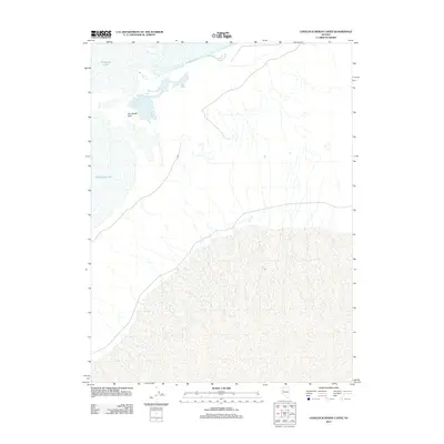
2011 Map of Lovelock Indian Caves
USGS Topo · Published 2011About this map
The Humboldt River terminates in this arid landscape of Churchill County, forming the distinctive hydrological terminal basin known as the Humboldt Sink. This 2011 survey documents a region where the waters of the Humboldt Lake fluctuate across a low-lying desert floor, creating an ever-shifting shoreline depending on seasonal inflow. The topography is dominated by the vast, sandy reaches of the Lahontan Basin, where the endorheic drainage system of northern Nevada finally concludes. Without any established towns or settlements on this quadrangle, the focus remains on the stark intersection of water and desert, showing the various braided channels and intermittent marshlands that define this terminal point of one of the West's most significant rivers.
Find a feature on this map
3 named features on this map. Tap any name to fly to it.
Don’t see what you’re looking for? This feature index may not catch every label — zoom into the map to look around manually.
Map Details
Editions of this 2011 Lovelock Indian Caves Map
This is the sole edition of this map. No revisions or reprints were ever made.
Other maps of this area

1908 · Carson Sink
USGS Topo · 1:250,000

1910 · Carson Sink
USGS Topo · 1:250,000

1931 · Lovelock
USGS Topo · 1:250,000

1935 · Lovelock
USGS Topo · 1:250,000

1951 · Carson Sink
USGS Topo · 1:62,500

1955 · Lovelock
USGS Topo · 1:250,000

1956 · Toulon
USGS Topo · 1:62,500

1956 · Lovelock
USGS Topo · 1:62,500

1957 · Reno
USGS Topo · 1:250,000

1959 · Lovelock
USGS Topo · 1:250,000