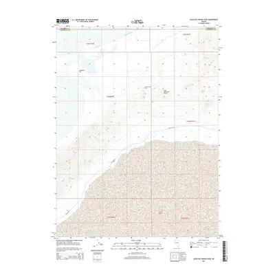
2014 Map of Lovelock Indian Caves
USGS Topo · Published 2014About this map
Lovelock Indian Caves sits on the western flank of the West Humboldt Range, overlooking a basin where the hydrological systems of northern Nevada converge. The map documents the termination of the Humboldt River as it feeds into Humboldt Lake and the vast Humboldt Sink. This terminal basin landscape is a study in Great Basin geography, showing the transition from the steep contours of the range down to the alkaline flats of the Carson Sink to the south. The presence of Pole Line Rd following the base of the mountains provides a modern reference point across this arid terrain, marking the boundary between the rugged highlands and the ancient lake beds that define the border of Pershing Co and Churchill Co.
Find a feature on this map
14 named features on this map. Tap any name to fly to it.
Don’t see what you’re looking for? This feature index may not catch every label — zoom into the map to look around manually.
Map Details
Editions of this 2014 Lovelock Indian Caves Map
This is the sole edition of this map. No revisions or reprints were ever made.
Other maps of this area

1908 · Carson Sink
USGS Topo · 1:250,000

1910 · Carson Sink
USGS Topo · 1:250,000

1931 · Lovelock
USGS Topo · 1:250,000

1935 · Lovelock
USGS Topo · 1:250,000

1951 · Carson Sink
USGS Topo · 1:62,500

1955 · Lovelock
USGS Topo · 1:250,000

1956 · Toulon
USGS Topo · 1:62,500

1956 · Lovelock
USGS Topo · 1:62,500

1957 · Reno
USGS Topo · 1:250,000

1959 · Lovelock
USGS Topo · 1:250,000