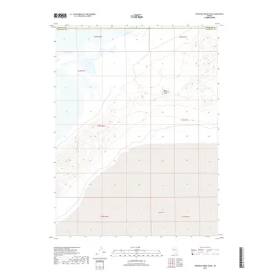
2018 Map of Lovelock Indian Caves
USGS Topo · Published 2018About this map
The West Humboldt Range dominates the eastern half of this landscape, its steep contours rising above the Great Basin floor. This arid region of Nevada is defined by its endorheic hydrology, where the Humboldt River and Battle Lakes feed into the expansive, seasonally fluctuating Humboldt Lake and the lower Humboldt Sink. To the south, the terrain levels out into the northern reaches of the Carson Sink, creating a stark transition between the mountain foothills and the terminal alkaline flats. The map illustrates a complex network of township and range divisions, such as t24n r30e and t25n r31e, crossing the border between Pershing and Churchill Counties. This topography reveals the terminal drainage patterns of the Humboldt system before it disappears into the desert basin.
Find a feature on this map
13 named features on this map. Tap any name to fly to it.
Don’t see what you’re looking for? This feature index may not catch every label — zoom into the map to look around manually.
Map Details
Editions of this 2018 Lovelock Indian Caves Map
This is the sole edition of this map. No revisions or reprints were ever made.
Other maps of this area

1908 · Carson Sink
USGS Topo · 1:250,000

1910 · Carson Sink
USGS Topo · 1:250,000

1931 · Lovelock
USGS Topo · 1:250,000

1935 · Lovelock
USGS Topo · 1:250,000

1951 · Carson Sink
USGS Topo · 1:62,500

1955 · Lovelock
USGS Topo · 1:250,000

1956 · Toulon
USGS Topo · 1:62,500

1956 · Lovelock
USGS Topo · 1:62,500

1957 · Reno
USGS Topo · 1:250,000

1959 · Lovelock
USGS Topo · 1:250,000