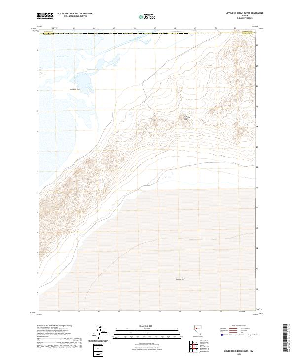
2021 Map of Lovelock Indian Caves
USGS Topo · Published 2021About this map
The West Humboldt Range dominates this landscape on the border of Pershing and Churchill counties, where the high desert meets the terminal drainage of the northern Great Basin. The map details a critical hydrological junction where the Humboldt River and Battle Lakes feed into the expansive Humboldt Lake. To the south, the topography transitions into the massive depressions of the Humboldt Sink and the northern edge of the Carson Sink. This area represents a significant geographical terminus; historically, this region served as a final, challenging milestone for westward travelers following the river before they faced the daunting salt flats and sinks. The stark contrast between the steep ridgelines of the range and the vast, flat basins of the sinks is clearly delineated by the modern topographic contours, illustrating the natural containment of these desert waters.
Find a feature on this map
13 named features on this map. Tap any name to fly to it.
Don’t see what you’re looking for? This feature index may not catch every label — zoom into the map to look around manually.
Map Details
Editions of this 2021 Lovelock Indian Caves Map
This is the sole edition of this map. No revisions or reprints were ever made.
Other maps of this area

1908 · Carson Sink
USGS Topo · 1:250,000

1910 · Carson Sink
USGS Topo · 1:250,000

1931 · Lovelock
USGS Topo · 1:250,000

1935 · Lovelock
USGS Topo · 1:250,000

1951 · Carson Sink
USGS Topo · 1:62,500

1955 · Lovelock
USGS Topo · 1:250,000

1956 · Toulon
USGS Topo · 1:62,500

1956 · Lovelock
USGS Topo · 1:62,500

1957 · Reno
USGS Topo · 1:250,000

1959 · Lovelock
USGS Topo · 1:250,000