
1942 Map of Lovewell Mountain
USGS Topo · Published 1942About this map
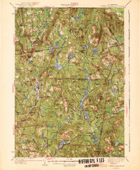
Lovewell Mountain anchors a landscape defined by its high-altitude ponds and scattered rural settlements across the border of Sullivan and Cheshire Counties. This 1942 edition reflects a region of New Hampshire where early industrial sites like Gee Mill and Mill Village persisted alongside a growing recreational footprint, seen in the camps and Dodge State Forest. The map documents a dense network of upland roads connecting small centers such as Marlow, Stoddard, and East Washington. Notable local landmarks like the Advent Ch, School No 5, and the Meetinghouse in the south provide valuable points of reference for genealogists tracing family locations in these hill towns. The intricate drainage of the Ashuelot River and its numerous reservoirs, including Ashuelot Pond and Highland Lake, illustrates the vital role of water management in both the historical mill economy and the surrounding timberlands.
Find a feature on this map
154 named features on this map. Tap any name to fly to it.
Don’t see what you’re looking for? This feature index may not catch every label — zoom into the map to look around manually.
Map Details
Editions of this 1942 Lovewell Mountain Map
4 editions found
Other maps of this area

1898 · Monadnock
USGS Topo · 1:62,500

1898 · Keene
USGS Topo · 1:62,500

1900 · Peterboro
USGS Topo · 1:62,500

1902 · Sunapee
USGS Topo · 1:62,500

1905 · Sunapee
USGS Topo · 1:62,500

1907 · Sunapee
USGS Topo · 1:62,500

1926 · Hillsboro
USGS Topo · 1:62,500

1926 · Claremont
USGS Topo · 1:62,500

1927 · Bellows Falls
USGS Topo · 1:48,000

1928 · Mount Kearsarge
USGS Topo · 1:62,500